The Escambia County Property Appraiser Map is a reliable starting point for anyone researching land or property in the county. Through the interactive GIS search, you can view parcel boundaries, ownership details, and zoning layers all in one place. This tool helps simplify property research, whether you’re checking records for a potential purchase or confirming information on your own land.
Beyond basic parcel data, the GIS system gives users a clear view of neighborhoods and land use patterns across Escambia County. Buyers can compare properties, sellers can verify lot details, and researchers can review public records with confidence. By combining zoning, boundary, and assessor data, the interactive map makes property information more accessible and useful.
What is the Escambia County GIS Map?
The Escambia County Property Appraiser GIS is an interactive mapping tool that helps residents, property owners, and researchers view land information in a clear, visual format. GIS stands for Geographic Information System, a technology that connects maps with data. In property appraisal, this means you can see parcel boundaries, ownership details, and land features all in one place.
How GIS Works in Property Appraisal
A GIS map combines digital maps with property records stored in the county database. Instead of looking at spreadsheets or text-based reports, you can click on a parcel and see the key details instantly. This includes:
- Parcel boundaries and dimensions
- Owner name and mailing address
- Property value assessments
- Land use and zoning information
By linking data to geography, the system makes property research faster and easier to understand.
Why Escambia County Uses GIS
The property appraiser’s office uses GIS to provide accurate, up-to-date land records. This helps with:
- Fair and consistent property value assessments
- Transparency for taxpayers and real estate professionals
- Easy access to maps for planning, buying, or selling property
Instead of requesting paper maps or waiting for mailed documents, users can access the digital parcel viewer anytime.
Benefits of the GIS Map for Users
The Escambia County Property Appraiser GIS is more than just a map—it is a practical research tool. Users can:
- Search by address, parcel ID, or owner name
- View aerial imagery to see property features
- Check zoning and land use before making decisions
- Compare surrounding parcels for context
For anyone buying, selling, or studying property in Escambia County, this tool simplifies the process of finding reliable land records.
Features of the Escambia County Property Appraiser Map Search
The Escambia County Property Appraiser Map Search is more than a simple lookup tool. It gives residents, buyers, sellers, and professionals an interactive way to explore detailed property data. With easy-to-use functions, users can access land records and visualize property details directly on the map.
Core Search Functions
The map search offers multiple ways to find a property:
- Address Search – Quickly locate a property by typing its street address.
- Parcel ID Search – Enter the official parcel identification number for direct results.
- Owner Name Search – Look up properties linked to a specific owner.
These options make it simple to find the exact parcel you need, whether for research, tax purposes, or real estate planning.
Property Boundaries and Dimensions
One of the most useful features is the ability to view property lines and lot dimensions. The map provides a clear outline of each parcel, helping users confirm boundaries before purchasing, selling, or developing land. This feature often works as a digital plat map search, giving clarity without needing paper records.
Zoning and Land Use Layers
The Escambia County Property Appraiser Map Search includes overlay tools that display zoning categories and land use information. With a few clicks, you can check whether a property is residential, commercial, or agricultural. This helps buyers and developers understand the permitted uses of a parcel before making investment decisions.
Measuring Tools
The map comes equipped with tools that allow users to:
- Measure distances between points on a property
- Calculate acreage with accuracy
- Estimate dimensions for planning or comparison
This feature saves time and reduces guesswork for surveyors, planners, and anyone evaluating land size.
Aerial and Satellite Imagery
For a closer look at land features, the system includes aerial and satellite views. Users can switch between standard map mode and imagery to see buildings, vegetation, roads, and surrounding properties. This makes the tool a practical land parcel viewer for both casual users and real estate professionals.
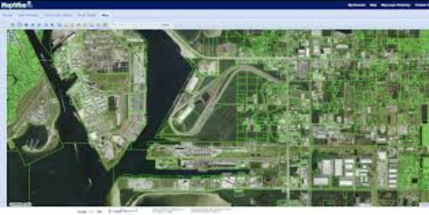
Explore the Full-Screen Viewer
For the best experience, use the expanded version of the GIS tool. The full-screen mode gives you more space to view parcels, layer maps, and analyze property data.
How to Use the GIS Map Search Step by Step
The Escambia County Florida Property Appraiser Map makes property research more interactive and practical. Whether you’re checking a parcel before purchase, confirming zoning details, or reviewing flood zones, the map provides quick answers in just a few clicks.
Follow these steps to get the most from the tool:
Step 1: Open the Map Viewer
Start by accessing the online map viewer from the Property Appraiser’s website. The tool opens in your browser—no downloads required.
Step 2: Enter Property Details
Use the search bar to type in:
- Parcel ID if you already know the unique number.
- Owner name for ownership lookups.
- Street address if that’s the easiest point of reference.
This instantly highlights the property on the map.
Step 3: Turn Layers On or Off
The left-hand menu lets you toggle different map layers. Popular options include:
- Zoning districts to check land use rules.
- Flood zones to see FEMA-designated risk areas.
- Subdivision outlines to understand neighborhood boundaries.
Turning layers on or off gives you a clear picture tailored to your research needs.
Step 4: Export or Print Parcel Maps
Once you’ve found the right parcel, you can:
- Print a property map for reports or records.
- Export a digital version for project planning.
Both options save time compared to requesting maps in person.
Extra Tool Placement Idea
To make this section even more practical, place a mini parcel lookup box right here. Visitors can enter an address or parcel number without scrolling back to the top of the page. This creates a smoother experience and keeps users engaged.
Types of GIS Layers Available in Escambia County
The Escambia County Property Appraiser GIS system offers multiple map layers that give residents, property buyers, and researchers detailed insights into local land and community data. These layers make it easier to evaluate properties, plan projects, and understand how different factors affect a specific location.
Parcel Boundaries and Ownership Data
This layer shows exact property lines along with parcel identification numbers. Users can check who owns a parcel, compare boundary lines, and see lot sizes. This information is helpful for buyers reviewing potential purchases, surveyors confirming measurements, and property owners who want to verify their records.
Land Use and Zoning Districts
Zoning and land use layers outline how each area can be used—whether for residential, commercial, industrial, or agricultural purposes. These maps help investors, developers, and homeowners see what types of projects are permitted in different zones and whether a property fits their intended plans.
Flood Hazard Zones (FEMA)
The GIS includes Federal Emergency Management Agency (FEMA) flood hazard maps. These zones highlight areas with different levels of flood risk. Homeowners, real estate agents, and insurance providers often rely on this data to evaluate risk and determine insurance requirements.
School Districts and Voting Precincts
Community-related layers show school district boundaries and local voting precincts. Families can confirm which schools serve their address, while residents can check their voting district for upcoming elections. These layers make it simple to connect property locations with community services.
Transportation and Utility Layers
Transportation and utility maps cover roads, highways, and public infrastructure such as water and sewer lines. These layers are valuable for developers, planners, and anyone considering how accessible a property may be. They also provide insight into future growth and development in the county.
Aerial Imagery & Historical Maps
The Escambia County Property Appraiser Map provides more than just parcel lines and zoning data. It also offers aerial imagery and access to historical maps that help users see how land and communities have changed over time. These tools give a unique perspective that complements traditional property records.
Satellite Views and Orthophotos
High-resolution satellite images and orthophotos give a clear, accurate picture of the ground. Orthophotos are corrected for scale, which means distances and shapes match true measurements. Property owners, buyers, and surveyors can use these images to confirm features such as driveways, fences, tree lines, or nearby structures. Developers often review them to understand current land conditions before starting a project.
Comparing Current and Historical Imagery
The map allows users to compare present-day aerial views with older images and historic plat maps. This comparison shows how neighborhoods have grown, how land use has shifted, or where natural features like rivers or wetlands may have changed over the decades. Researchers and local historians often find this feature useful for tracing community development and preserving records of past land use.
Uses for Developers, Surveyors, and Historians
- Developers can assess changes in surrounding land and infrastructure before committing to a site.
- Surveyors can reference imagery when validating boundaries or checking for encroachments.
- Historians gain valuable insights into how farms, towns, and public spaces have evolved.
These layers enrich the Escambia County Property Appraiser Map by adding context that traditional parcel records alone cannot provide. Whether for planning, research, or documentation, aerial and historical imagery offers a powerful way to connect the past with the present.
Why Use GIS Maps? (Benefits by Audience)
The Escambia County Property Appraiser Map Search is more than a parcel lookup tool. It provides visual data that different audiences can use to answer practical questions, solve problems, and make better decisions.
Homebuyers and Property Owners
For anyone purchasing or owning property, the map makes it simple to confirm lot size, verify boundaries, and view nearby features. This helps buyers avoid surprises during closing and gives owners peace of mind about their records.
Realtors
Realtors often use the map to compare neighborhoods side by side. By viewing zoning, nearby schools, and transportation access on one screen, they can present clearer options to clients. This saves time and adds confidence to the buying process.
Developers and Builders
The zoning and land use layers are critical for development projects. Builders can quickly see where commercial or residential projects are permitted, check infrastructure availability, and understand long-term growth patterns. This helps reduce risks before committing to a site.
Lawyers and Legal Professionals
Boundary disputes or ownership questions often require accurate map data. GIS layers showing parcel lines, historical maps, and aerial imagery can support legal cases by providing visual evidence. Lawyers rely on this information to clarify issues and resolve conflicts.
Government and Public Agencies
Local government agencies use the map for community planning, property tax assessment, and emergency response. Whether it’s planning new infrastructure, reviewing property values, or identifying at-risk areas during a storm, GIS data plays a central role in decision-making.
GIS vs. Traditional Property Records
The Escambia County Property Appraiser GIS provides more than a simple list of records. Traditional property records are text-based, offering details such as parcel ID, ownership, and assessed value. While valuable, this format can be hard to visualize—especially when comparing multiple parcels or trying to understand boundaries.
Text-Based Records
Paper files and digital record searches list property information in rows and columns. They confirm ownership history, legal descriptions, and tax details, but they don’t always help users picture where a property begins or ends. Reading descriptions like “Lot 12, Block 3” often leaves buyers and owners with more questions than answers.
Visual Parcel Mapping
GIS maps bridge that gap by showing property lines on a map, overlaid with data such as zoning, flood zones, or school districts. This approach turns raw data into a visual tool, making it easier to see how parcels connect and how land is used.
Why GIS Offers Better Transparency
- Boundary verification – Users can confirm lot sizes and boundary lines instantly.
- Contextual insight – Overlays reveal nearby roads, utilities, and zoning districts.
- Decision support – Buyers, developers, and local agencies can use visuals to plan with greater clarity.
Practical Example
A buyer reviewing a property through text records may know its square footage, but only through the Escambia County Property Appraiser GIS can they see how the lot sits next to neighbors, roads, or flood zones. This side-by-side view removes uncertainty and makes property research far more transparent.
Advanced GIS Features & Tools
The Escambia County Florida Property Appraiser Map includes advanced tools that go beyond basic parcel searches. These features give both everyday users and professionals the ability to interact with property data in practical ways.
Drawing and Measuring Tools
Users can draw shapes directly on the map to outline areas of interest. The measuring tool calculates distance, perimeter, and acreage, which is especially useful for surveyors, builders, and homeowners who want quick checks without hiring a professional.
Custom Map Layers for Professionals
Professionals such as developers, engineers, and planners can enable or disable map layers to focus on the data they need most. This flexibility makes it easier to compare zoning, utilities, flood zones, or transportation routes in a single view.
Download and Export Options
The system allows users to download or export data for use in planning software. Shapefiles, parcel data layers, and assessor’s digital maps can be saved and integrated into professional workflows. This feature supports detailed planning and analysis beyond the web viewer.
Mobile Integration
The map is accessible on mobile devices, making it easy to check property details in the field. Realtors can confirm property boundaries during showings, while inspectors and contractors can review data directly on-site.
FAQs About Escambia County GIS Maps
Searching for property information in Escambia County often starts with the GIS property map. This tool is widely used by buyers, sellers, appraisers, and researchers who need quick access to parcel details. Below are some of the most common questions people ask about the system, answered in clear and practical terms.
How do I search property by map in Escambia County?
You can look up a property by opening the Escambia County GIS map viewer. The map allows you to search by parcel ID, address, or owner name. Once you find the parcel, you can click on it to see property data such as acreage, zoning, and assessed value. This makes it easier to connect map visuals with official records.
Are GIS property maps free to use?
Yes. The Escambia County GIS maps are available online at no cost. Anyone with an internet connection can access the system. While the maps are free to view, certified documents such as surveys, plats, or deeds may need to be purchased through the county clerk or other offices
Can I download a parcel map with dimensions?
The GIS system usually allows users to print or export a map of the selected parcel. Dimensions and boundary lines are displayed, but they are for reference only. For legal accuracy—such as when building a fence or settling a boundary dispute—you would still need a professional survey.
Does the map show homestead exemption?
Yes. If a property has an approved homestead exemption, that status is often shown within the parcel details. You can click on the parcel to check whether the exemption is listed. Keep in mind that the exemption is tied to the property owner’s primary residence and must be filed through the Property Appraiser’s office.
How accurate are the GIS property boundaries?
The boundaries shown on GIS maps are drawn from county records and tax parcel data. They are generally reliable for research and comparison. Still, they should not be viewed as exact measurements. Lot lines on the map may not perfectly align with actual physical markers on the ground. For construction or legal disputes, a licensed survey is the only dependable option.
Can I view subdivision plats online?
Yes. Many subdivision plats are linked directly within the GIS map viewer. When you select a parcel in a platted subdivision, you may be able to open the associated plat document. If the plat is not available online, it can usually be requested through the Clerk of Court’s office.
How often is the GIS map updated?
The Escambia County GIS map is updated on a regular basis, often weekly or monthly, depending on the type of data. Updates reflect new property sales, ownership changes, and approved exemptions. This helps users trust that the information they see is fairly current, though official records will always be the most authoritative source.